General Information
Tusheti National Park, located in the northeastern part of Georgia, is renowned for its stunning landscapes characterized by dramatic mountain ranges, deep valleys, and lush meadows. Covering approximately 1,200 square kilometers, the park features elevations ranging from 1,500 to over 4,000 meters, offering breathtaking panoramic views.
The diverse flora includes alpine meadows, coniferous forests, and endemic plant species. The park is a biodiversity hotspot, home to various fauna, including the Caucasian red deer, chamois, and endangered species like the golden eagle and the Eurasian lynx.
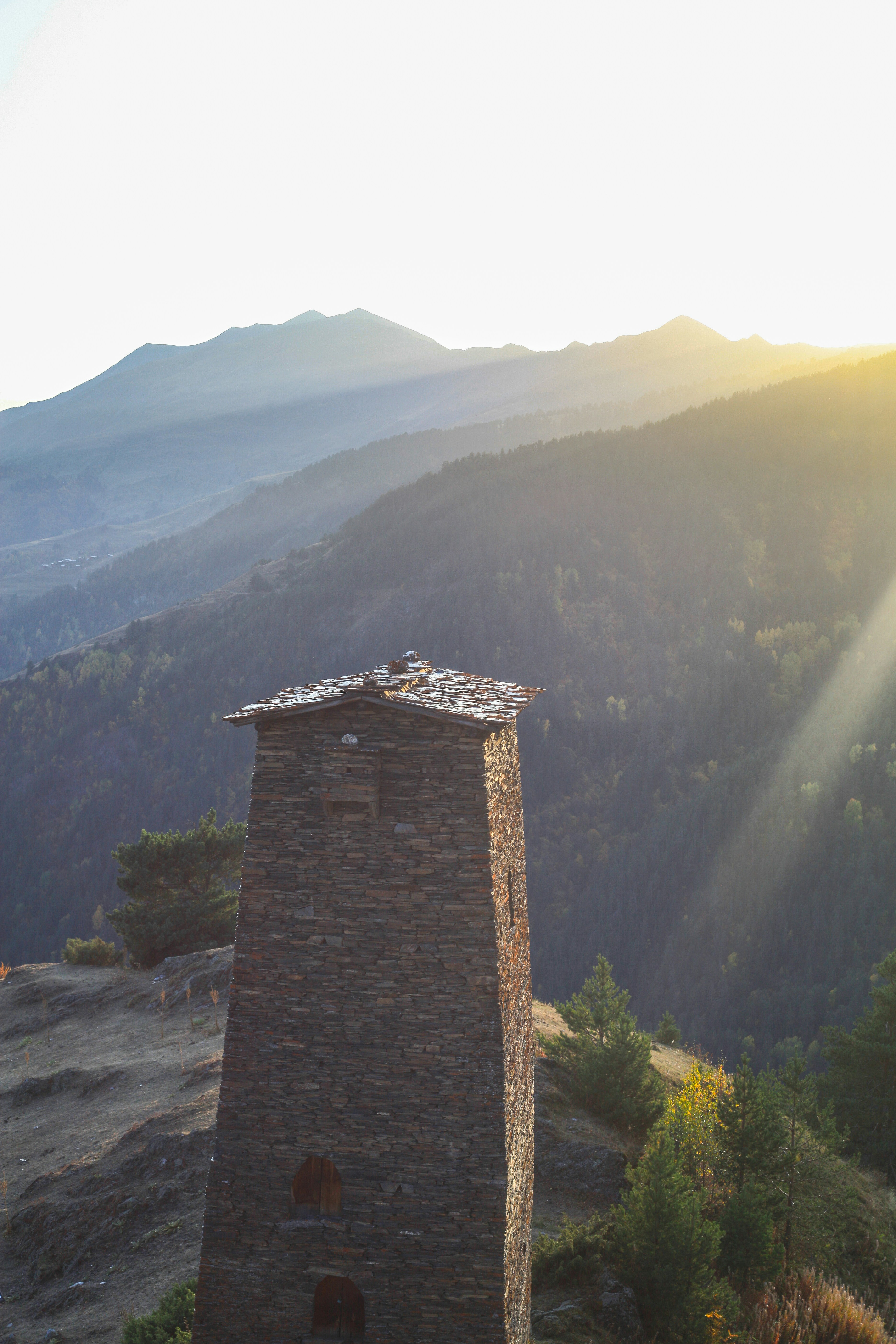
Tusheti is also rich in cultural heritage, with ancient villages and traditional stone towers dotting the landscape, making it a unique destination for nature lovers and cultural enthusiasts alike. The combination of its pristine environment and rich biodiversity makes Tusheti National Park a must-visit for those exploring Georgia’s natural beauty.
How to get there
By Car:
- To reach Tusheti National Park from Tbilisi, you can drive about 200 km northeast via the Tbilisi-Kakheti Highway, which takes around 4 to 5 hours.
By Minibus (Marshrutka):
- You can take a marshrutka (minibus) from the Didube Bus Station to Alvani, which takes approximately 3 to 4 hours and costs around 15-20 GEL. From Alvani, hire a 4×4 vehicle for the 1.5 to 2-hour ride to Omalo, the main village in Tusheti.
By Car:
- Borjomi-Kharagauli National Park is about 140 km (a 2-3 hour drive) from Kutaisi. Take the Kutaisi-Baghdati-Borjomi road (via the Tskaltubo region) and follow directions to Borjomi and the Likani entrance.
By Minibus:
- From Kutaisi, the journey is roughly 320 km. You can drive northeast toward Tbilisi and then to Alvani, taking about 6 to 7 hours, or take a marshrutka from Kutaisi to Tbilisi, then transfer to another minibus to Alvani, which will take around 6 to 7 hours total and cost approximately 25-30 GEL.
Tusheti National Park
Omalo – Dartlo – Dalo
Distance: 35.1 km
Elevation: 1,884 m
Difficulty: Hard 🔴
Distance: 35.1 km
Elevation: 1,884 m
Difficulty: Hard 🔴
The Omalo-Dartlo-Diklo trail in Tusheti National Park offers stunning highlights, including the picturesque medieval towers of Omalo and Dartlo, traditional Tushetian stone architecture, and sweeping views of the Alazani Valley. The trail leads through rugged terrain with alpine meadows, wildflowers, and mountain streams. Dartlo, a UNESCO World Heritage candidate, showcases beautifully preserved stone houses, while Diklo rewards trekkers with breathtaking views of the Greater Caucasus and the ancient fortress ruins near the Georgia-Dagestan border.
Ascent/Descent:  2982 m 2982 m  2982 m 2982 m | Distance: 35.05 km |
Oreti Lake
Distance: 24.5 km
Elevation: 1,679 m
Difficulty: Hard 🔴
Distance: 24.5 km
Elevation: 1,679 m
Difficulty: Hard 🔴
The Oreti Lake trail in Tusheti National Park offers breathtaking alpine scenery, taking hikers through lush meadows, wildflower fields, and high-altitude landscapes. The serene Oreti Lake, situated at 2,650 meters, is surrounded by dramatic mountain peaks, reflecting the stunning Caucasus skyline. The trek provides panoramic views of the Tusheti region, including the picturesque Omalo village and Alazani Valley below, making it a rewarding and peaceful destination for nature lovers and trekkers seeking solitude and beauty.
Ascent/Descent:  2475 m 2475 m  2475 m 2475 m | Distance: 24.47 km |
Nakaichopass to Jvarboseli
Distance: 14.0 km
Elevation: 1,112 m
Difficulty: Hard 🔴
Distance: 14.0 km
Elevation: 1,112 m
Difficulty: Hard 🔴
The Nakaicho Pass to Jvarboseli trail in Tusheti National Park offers breathtaking alpine views, passing through lush meadows, remote villages, and rugged mountain landscapes. At 2,900 meters, Nakaicho Pass reveals panoramic vistas of the Tusheti and Khevsureti regions. The trail is a challenging yet rewarding trek, ideal for adventurous hikers seeking Georgia's pristine wilderness.
Ascent/Descent:  1593 m 1593 m  1676 m 1676 m | Distance: 13.96 km |
Dartlo - Dano - Kvavlo
Distance: 10.0 km
Elevation: 439 m
Difficulty: Hard 🔴
Distance: 10.0 km
Elevation: 439 m
Difficulty: Hard 🔴
The Dartlo-Dano-Kvavlo trail in Tusheti National Park offers stunning views of traditional stone villages perched on mountainsides. Starting in Dartlo, it ascends to Dano and Kvavlo, where hikers are rewarded with panoramic vistas of the Pirikiti Valley. The trail combines cultural immersion with the beauty of untouched landscapes, making it a must for history and nature lovers.
Ascent/Descent:  886 m 886 m  886 m 886 m | Distance: 10.01 km |
Shenako Village to Mount Sonekhi
Distance: 7.4 km
Elevation: 568 m
Difficulty: Hard 🔴
Distance: 7.4 km
Elevation: 568 m
Difficulty: Hard 🔴
The Shenako Village to Mount Sonekhi trail in Tusheti National Park takes hikers from a picturesque, traditional village to stunning alpine heights. Ascending to 2,500 meters, the trail offers sweeping views of the surrounding valleys and the Greater Caucasus. The trek blends cultural charm with dramatic mountain scenery, perfect for those seeking both adventure and serenity.
Ascent/Descent:  729 m 729 m  729 m 729 m | Distance: 7.36 km |
Practical information

What to Pack
Hiking Gear
Sturdy hiking boots and weather-appropriate clothing (layers are key).
First Aid Kit
Always carry a basic first aid kit, especially if you're going on longer hikes.
Food & Water
Bring sufficient food & water for the duration of your hike.
Navigation
Maps and GPS are essential, as cell reception is limited. Maps are available at the visitor centers.
